An overview of our brilliant 5 day trip hiking around the Julian Alps in September 2015.
The best laid plans….
“Come and have a look at this Janneke” Knut beckons me over to the map of the Julian Alps in Slovenia that’s spread over the dining room table.
“The area is not that big, I think we can do quite a lot. See those little ladder symbols?”
“Yes…” I nod apprehensively. It’s hard to miss them – the map is covered.
“They’re via ferrata. It’s quite hard to plan a journey that doesn’t go past via feratta, but I’m sure it will be fine. They can’t be that bad”.
I continue my apprehensive nod. Of course darling, of course.
Day 1 – The mountains are really big.
“I think we might need to turn back”. I look up to the mountain and back over to Knut. “They’re pretty flipping massive mountains aren’t they?”. He nods.
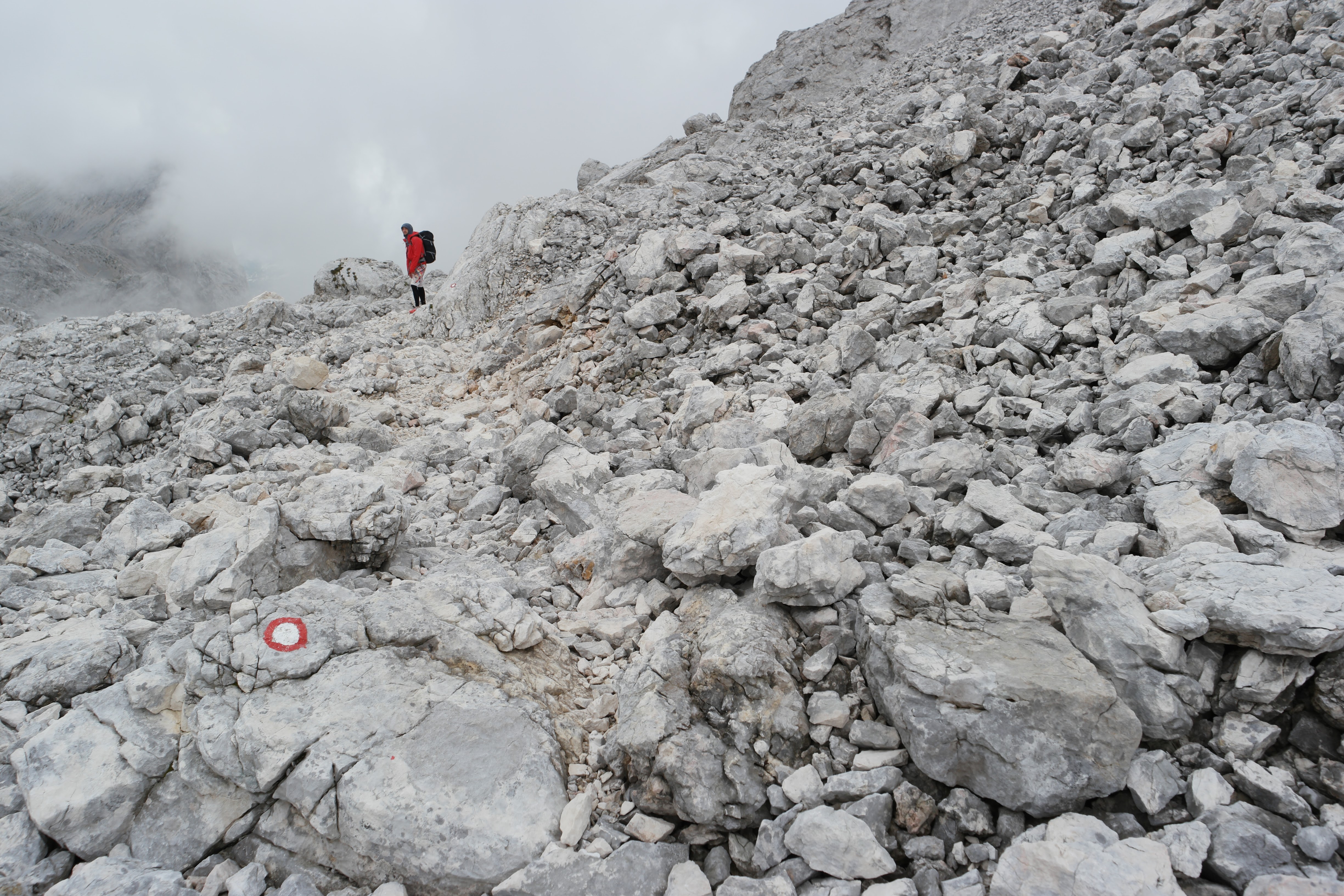
We’re two hours into our trek into the Julian Alps. It’s about 2pm, we have about 10km to go to get to the hut we’d planned to stay at. Problem is, there’s a ladder symbol between us and the hut. It’s a 5k walk to that ladder symbol. So, we kind of have to commit.
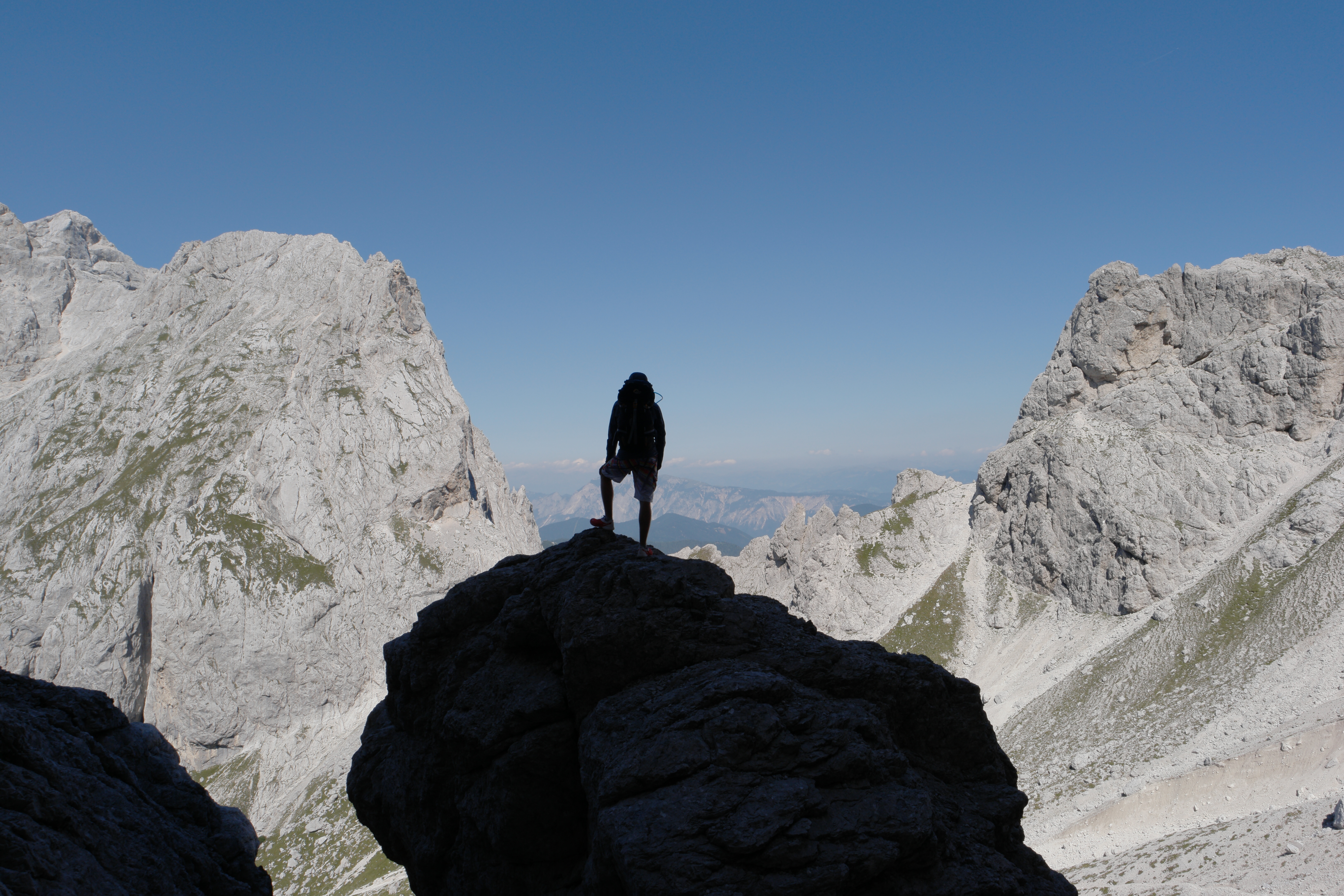
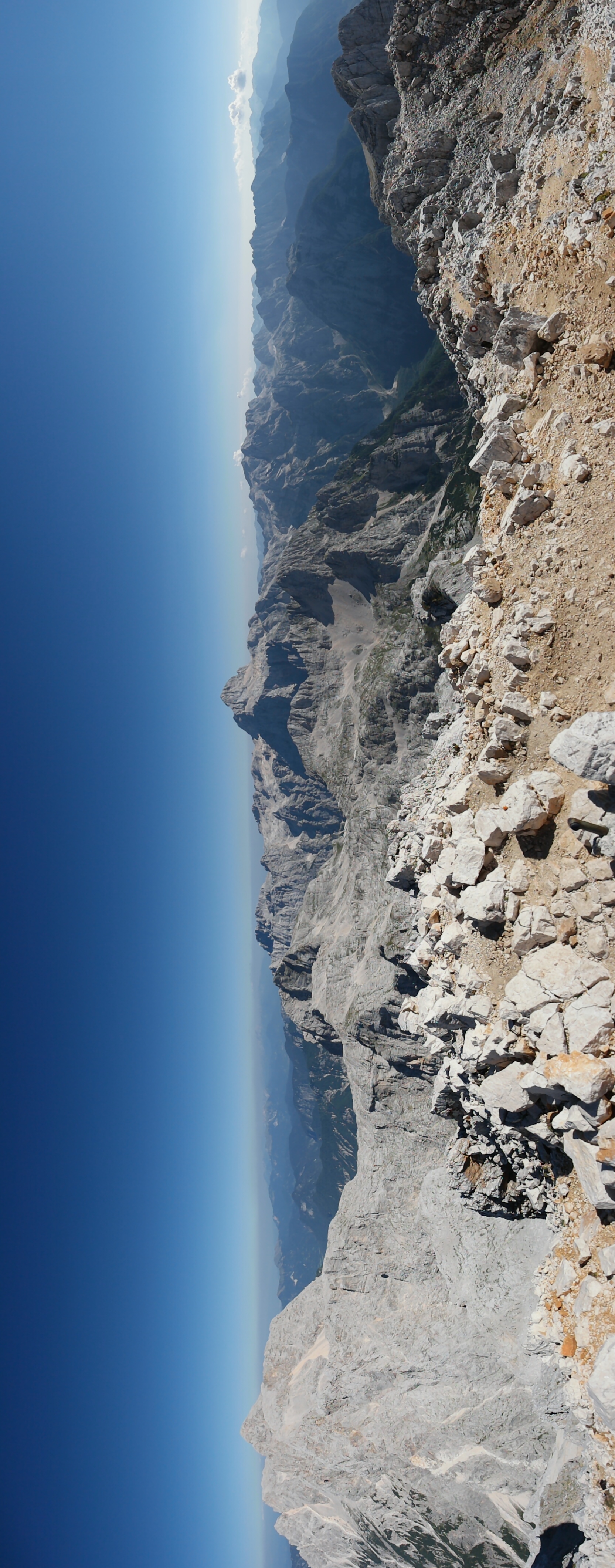
But the mountains looming in the distance are way more ominous then we’d expected. They’re very steep, very rugged, and very big. Pretty much everyone we’ve passed has helmets and via ferrata kits over their shoulders. It’s looking more and more likely they put those ladder symbols there for a reason.
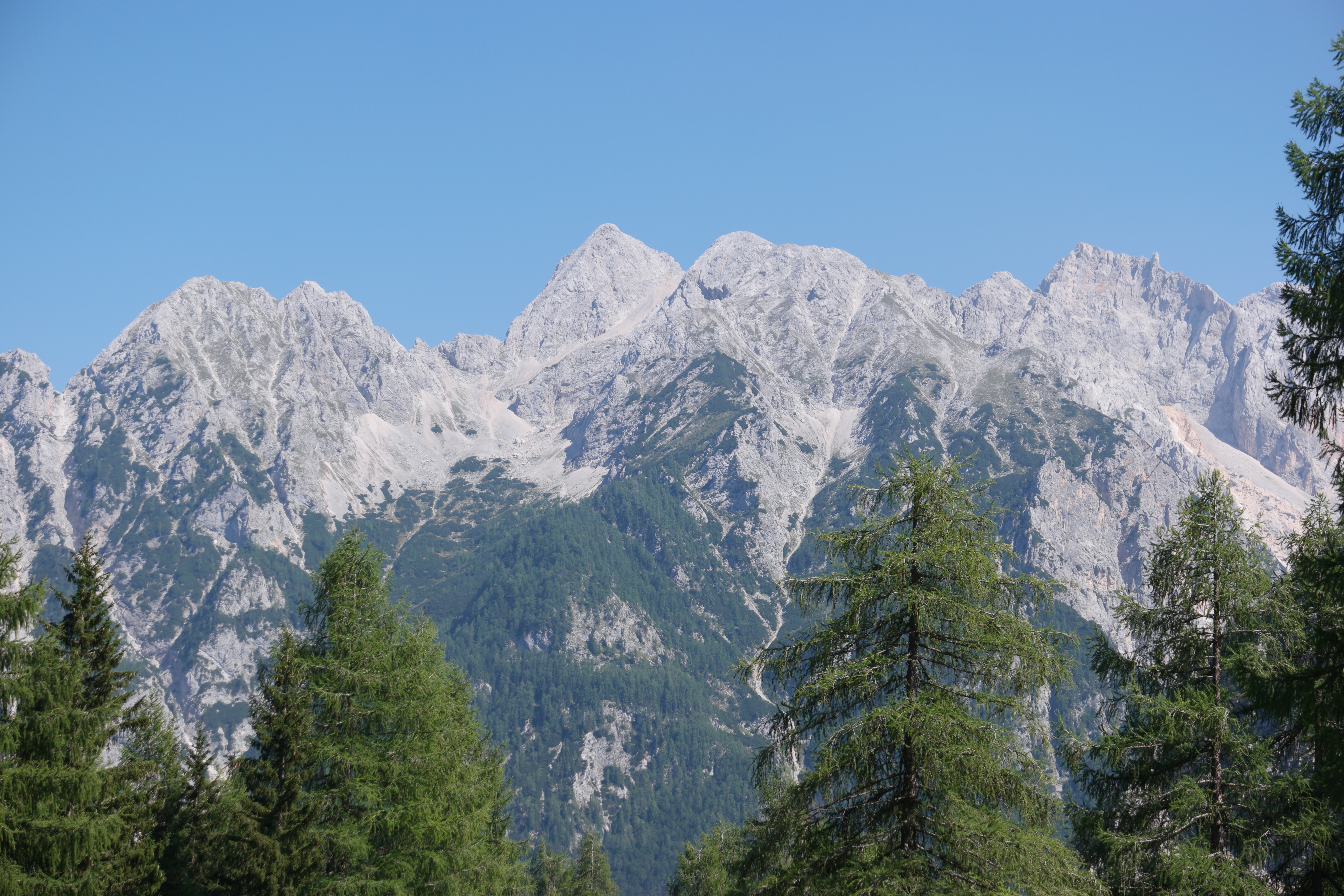
Mountains looking a lot bigger than we were expecting
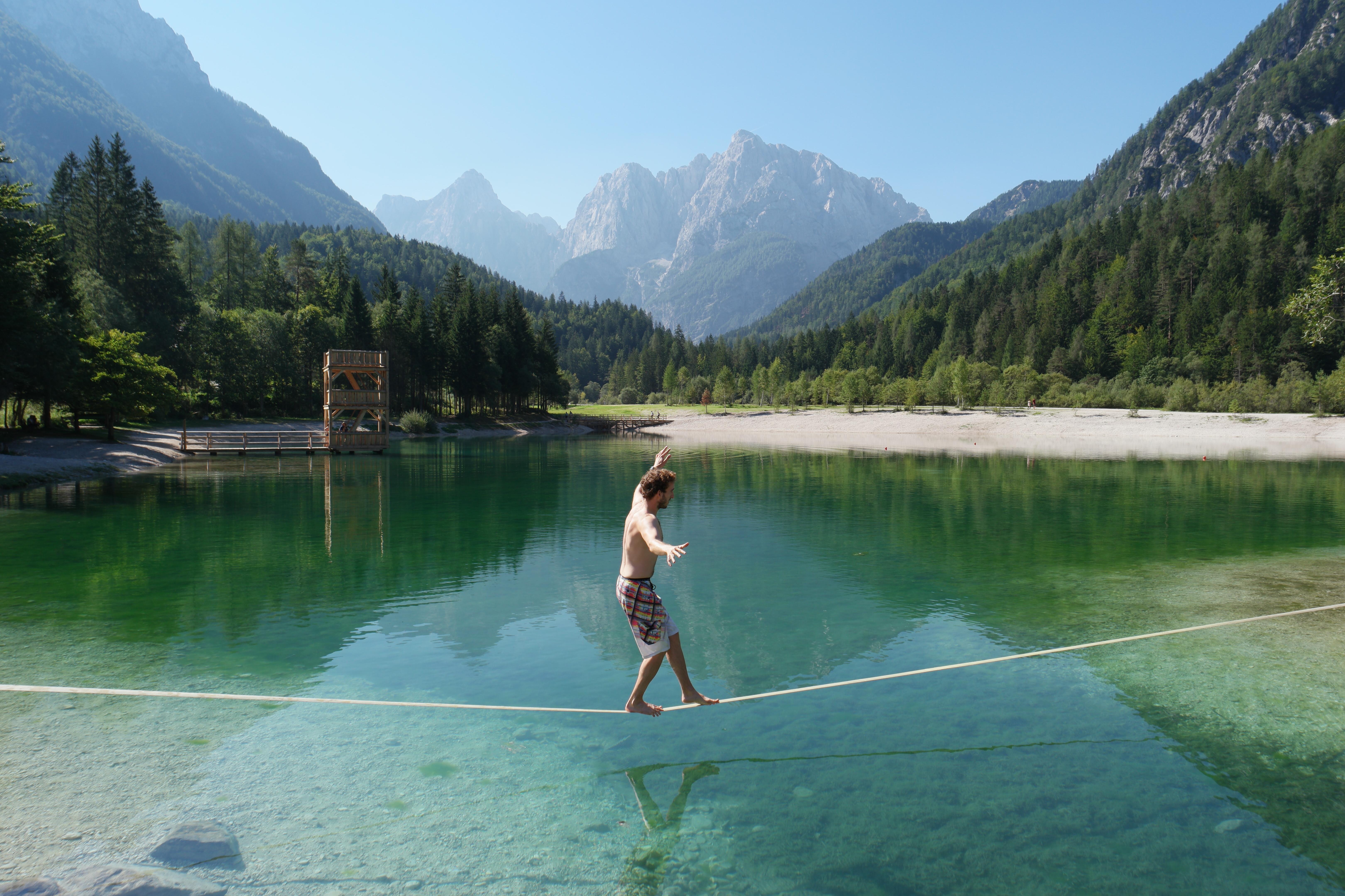
Starting off the walk with a bit of slacklining
We stop some other hikers and ask them about the route. They look us up and down. “Erm, it’s kind of up to you. If you’re confident climbers you’ll probably be fine”.
I look over to Knut. He is gazing longingly down the path.
I point out the obvious: “Knut, now let’s not be silly here…I’m more ‘terrified of heights” than “confident climber”.
He slowly peels his eyes away from the beckoning mountain and sighs.
We go back to the drawing board, furiously studying the map for another option. If we hitchhike up the road we won’t lose too much ground and then we can approach the hut from a different side. Sorted. Now to convince a car to pick us up.
This was surprisingly easy, and we were picked up after about 10 minutes by a Slovenian guy and his Latvian girlfriend, who just about fitted us into the back of their tiny car. They gave us a brief history of the Slovenian mountains as they drove us around the hairpin bends, before dropping us a stone’s throw away from the hut we needed.
It wasn’t exactly the start we expected, but we were already loving Slovenia.
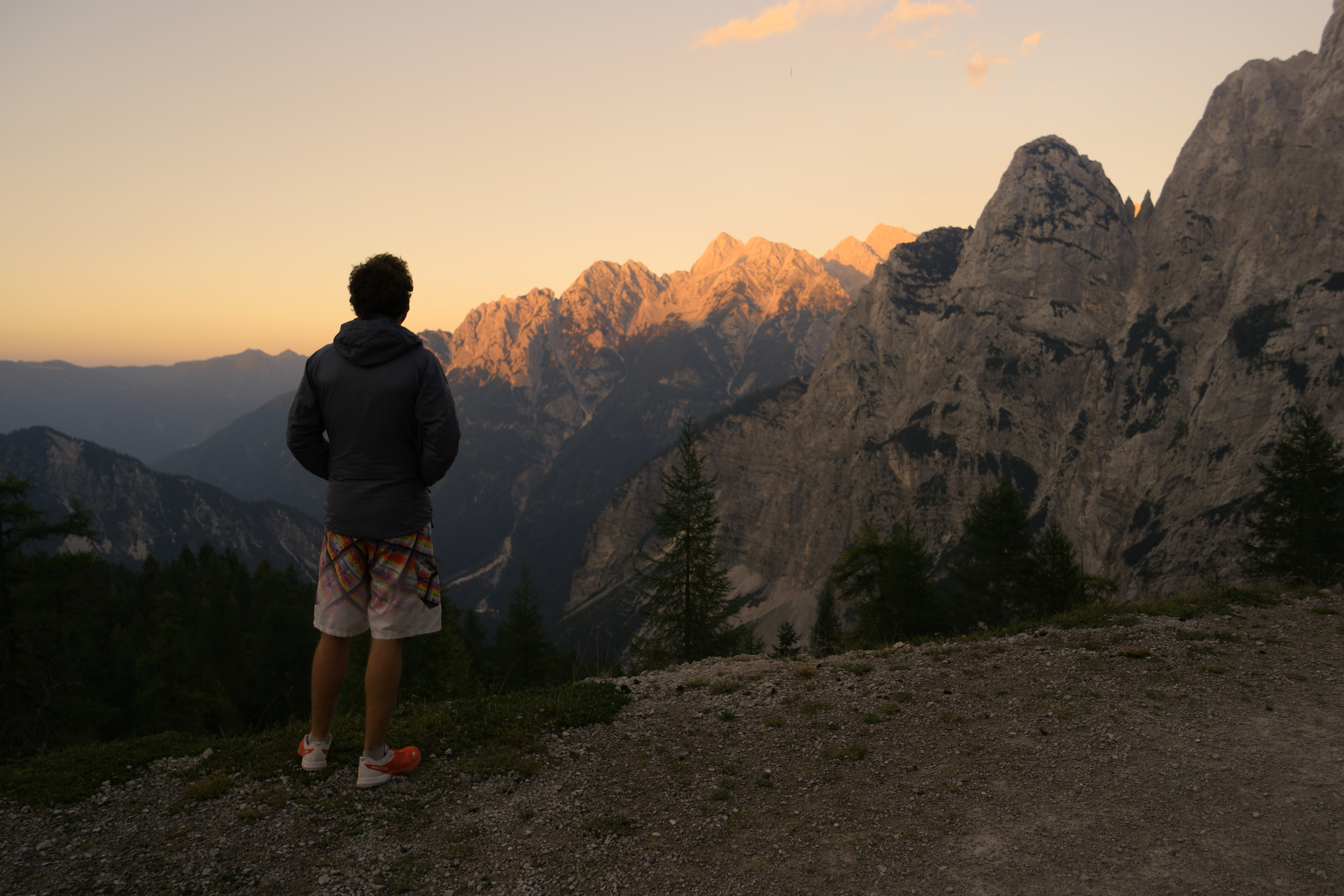
Watching the sunset over the mountains
Day 2 – Being brave
When deciding a route, choosing to go to places on the epicness of their names, is definitely a good approach (as is avoiding ladder symbols).
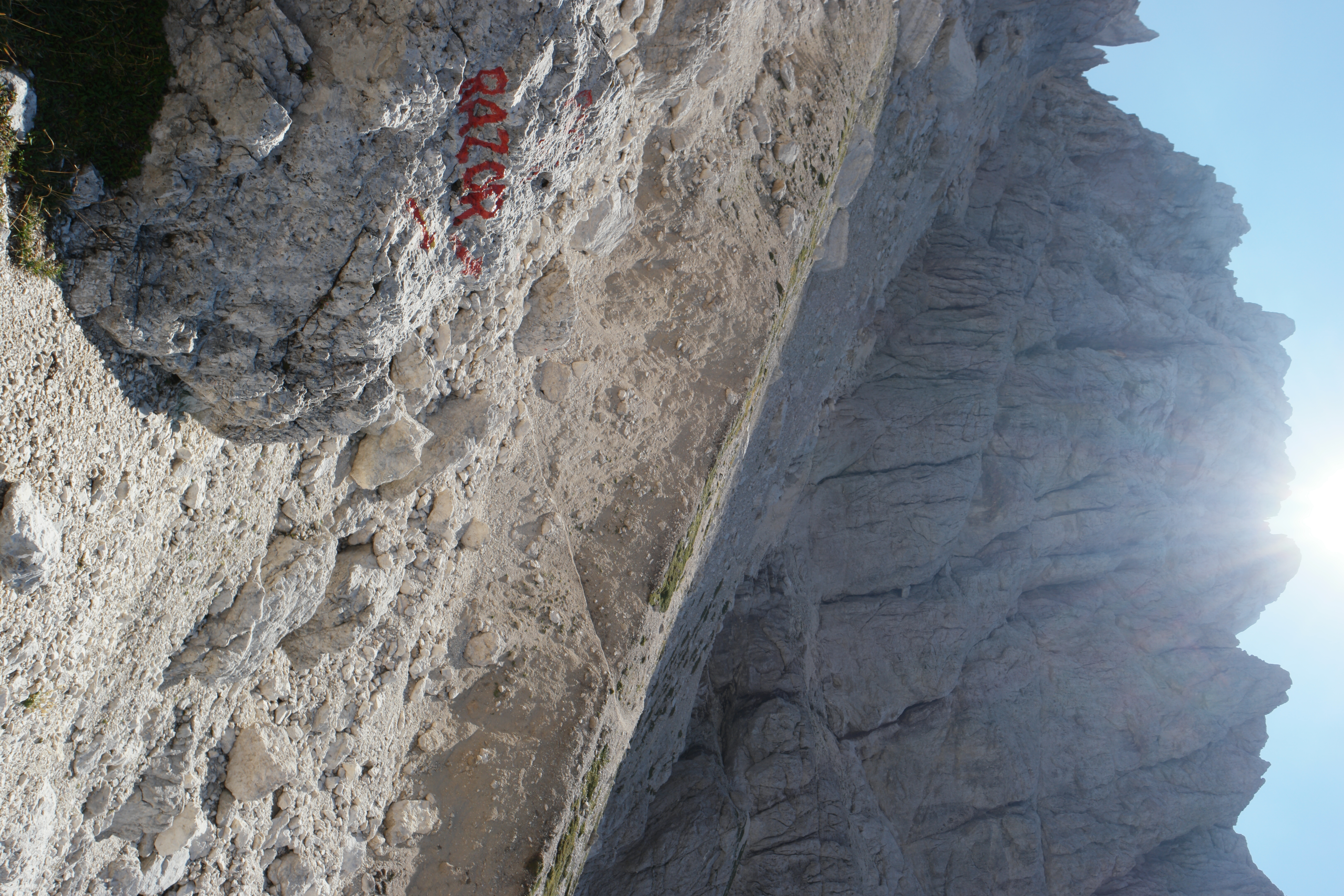
Enter RAZOR. One of the most evocatively epic names I’ve ever come across for a mountain. And, excitingly, it was on our route AND surprisingly free of ladder symbols.
On the way to Razor
However, a lack of ladder symbols didn’t mean it wasn’t free of ladders. Or, in fact, that it was easy to climb. We approached from the West, tentatively crossing sloping piles of scree, desperately hoping they would hold and we wouldn’t slide down the 1000m to the bottom of the valley. Scree is probably my least favourite walking surface (closely followed by bog!)

Walking across the scree
On the way to Razor
We reached 400metres from the top and were met with an expected ladder. I say ladder. It was more a series of precarious looking metal bars. I confidently stared up it. This would be fine. There was a metal “banister” to hold onto.
So off I went. But then….at about halfway up, I froze. Bloody hell it was high. How was I going to get down? I made a rookie error. I looked down. Tears started forming. I couldn’t do it. I couldn’t go up.
I started shaking as Knut stood below me, trying to calm me down. He talked me slowly back down from the ladder, my heart rate racing, unable to see the steps I was trying to reach with my feet.
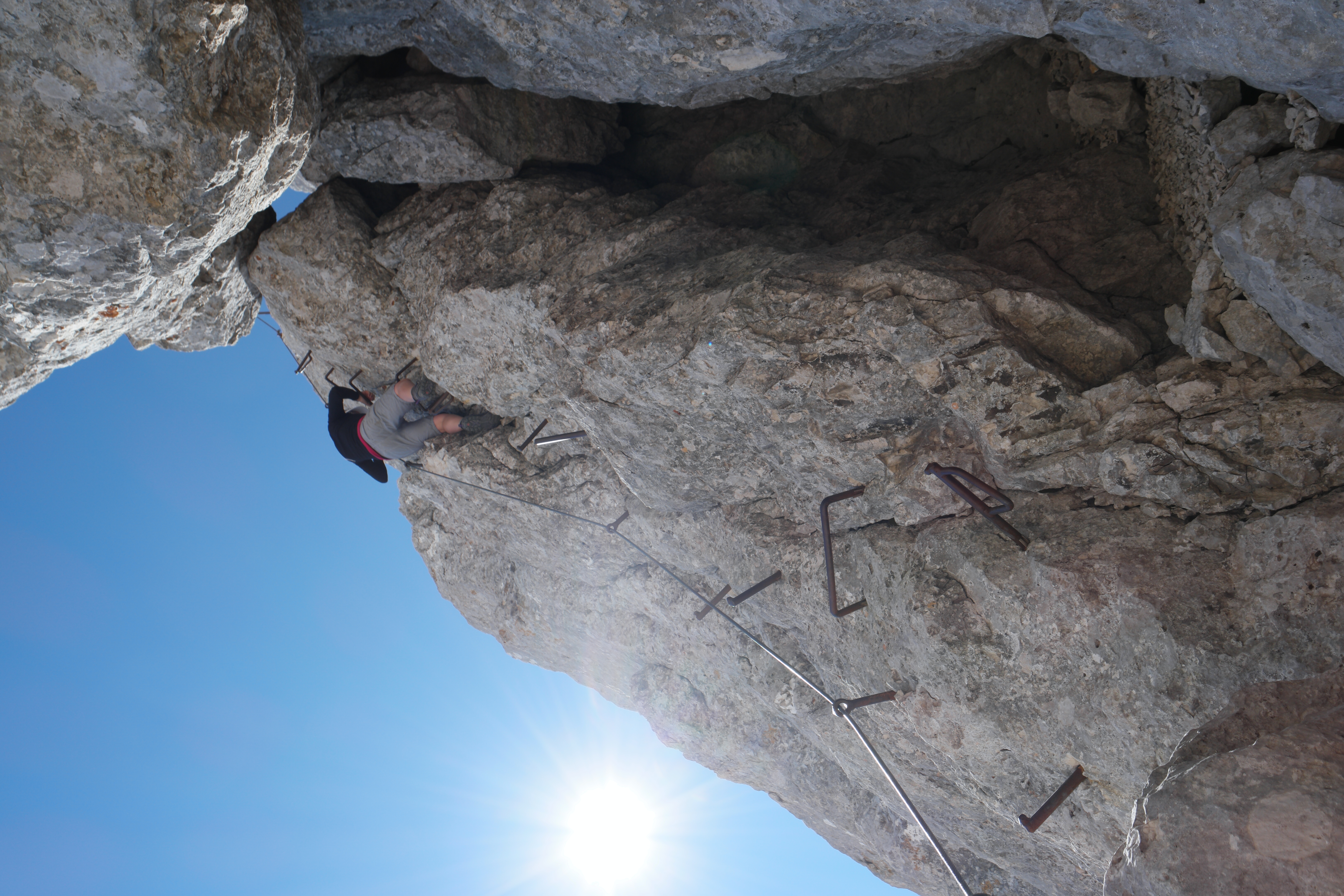
The infamous “ladder”!
I plopped down on a stone, crying with a mix of relief and being upset I wouldn’t get to the top of the best named mountain I’d ever come across. I told Knut to go ahead and get some awesome photos and I’d at least be able to pretend I was there.
I sat weeping and feeling sorry for myself for about 5 minutes, watching the ladder where Knut had ascended in seconds. Could I really come this far and not reach the top? No I bloody couldn’t.
I got up, completely alone on the side of the mountain, and climbed the flipping ladder. I didn’t look down. As I reached the top, I saw Knut prancing over the rocks, taking selfies and enjoying the view. I called out, and he looked over, shocked to see me peeping over the horizon.
I’d made it! And bloody hell was it worth it….!
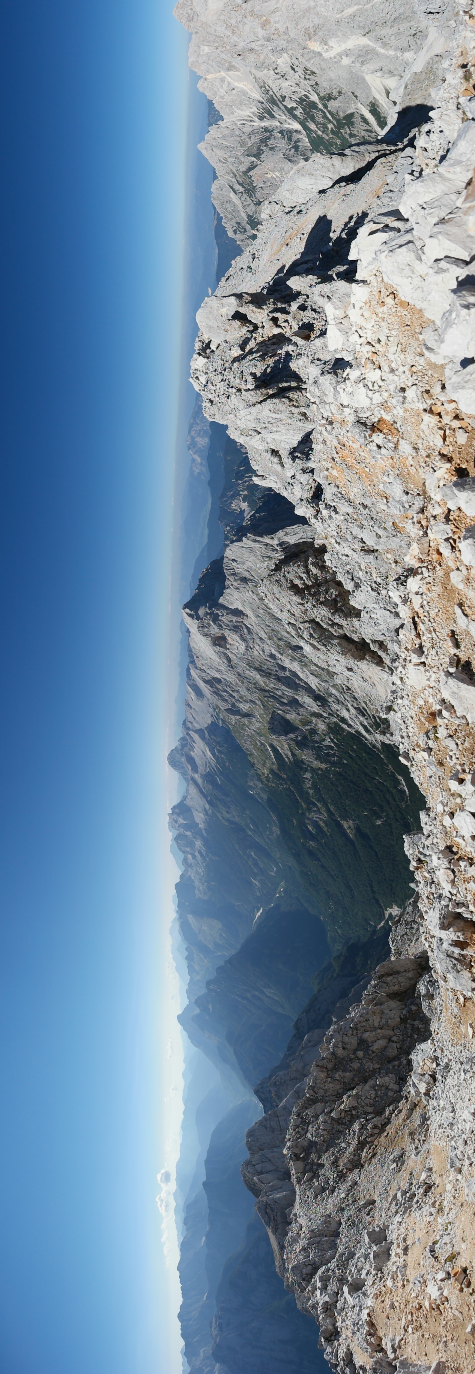
The view from the top of Razor (2601m)
The view from the top of Razor

Me creeping up behind Knut on the top of Razor (Proof I was there!)

Matching hats cos we’re cool kids
Day 3 – This place is stunning
Feeling buoyed from my ascent of Razor the previous day….I felt ready and able to take on the world. What was a ladder symbol to me now? Conqueror of Razor!
So rather than taking the sensible road….we went via another ladder symbol.
This was rather stressful. Did I mention my fear of heights? Well I’m also clumsy. Prone to tripping. Falling over.
This really comes into focus when the fall is about 600m. Into rock.
I have never held onto to a piece of metal so hard in my life. But (obvs) I made it! (so did Knut but that goes without saying as he is cut from the same cloth as a mountain goat).
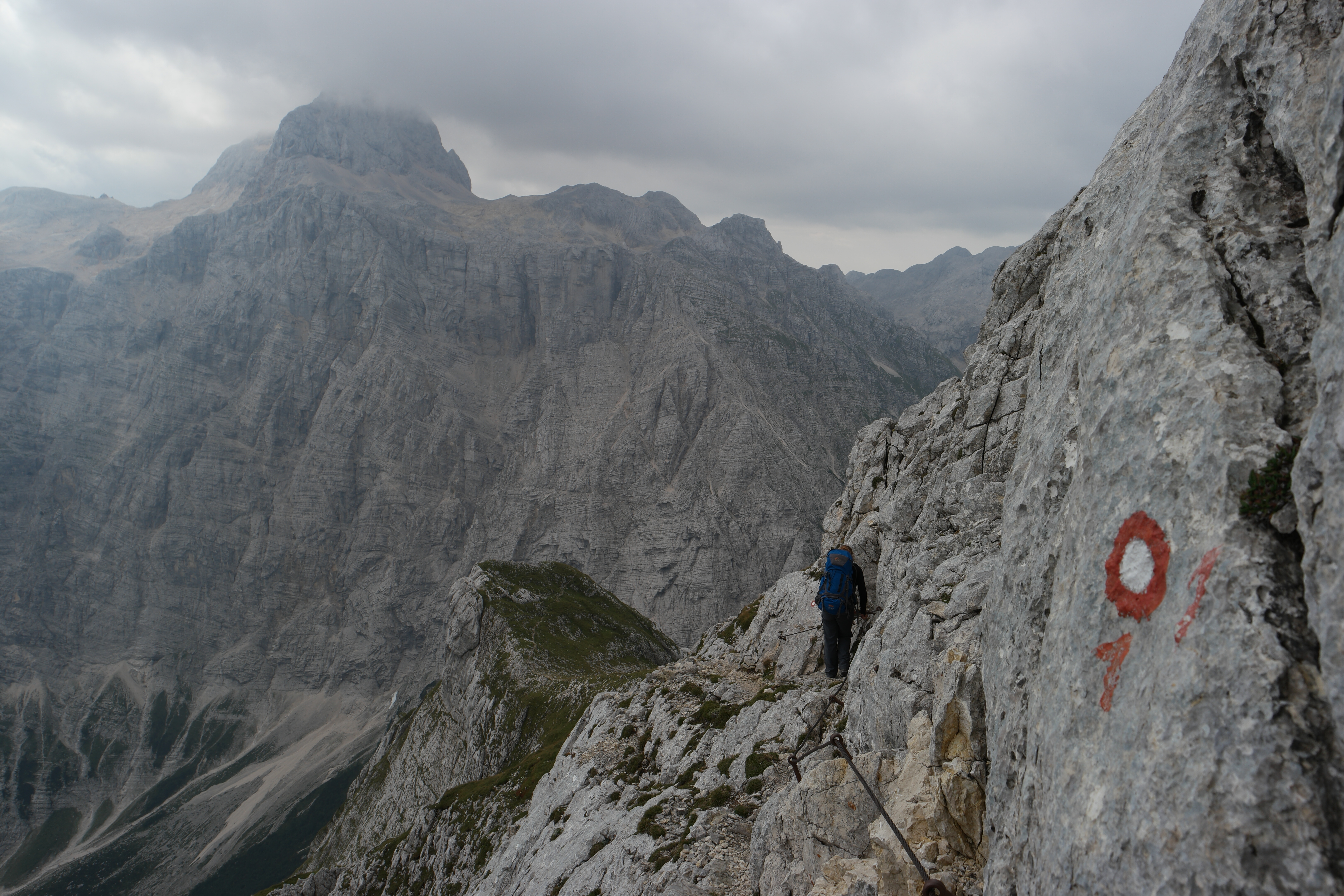
Walking along fairly precarious paths (not for the faint hearted)

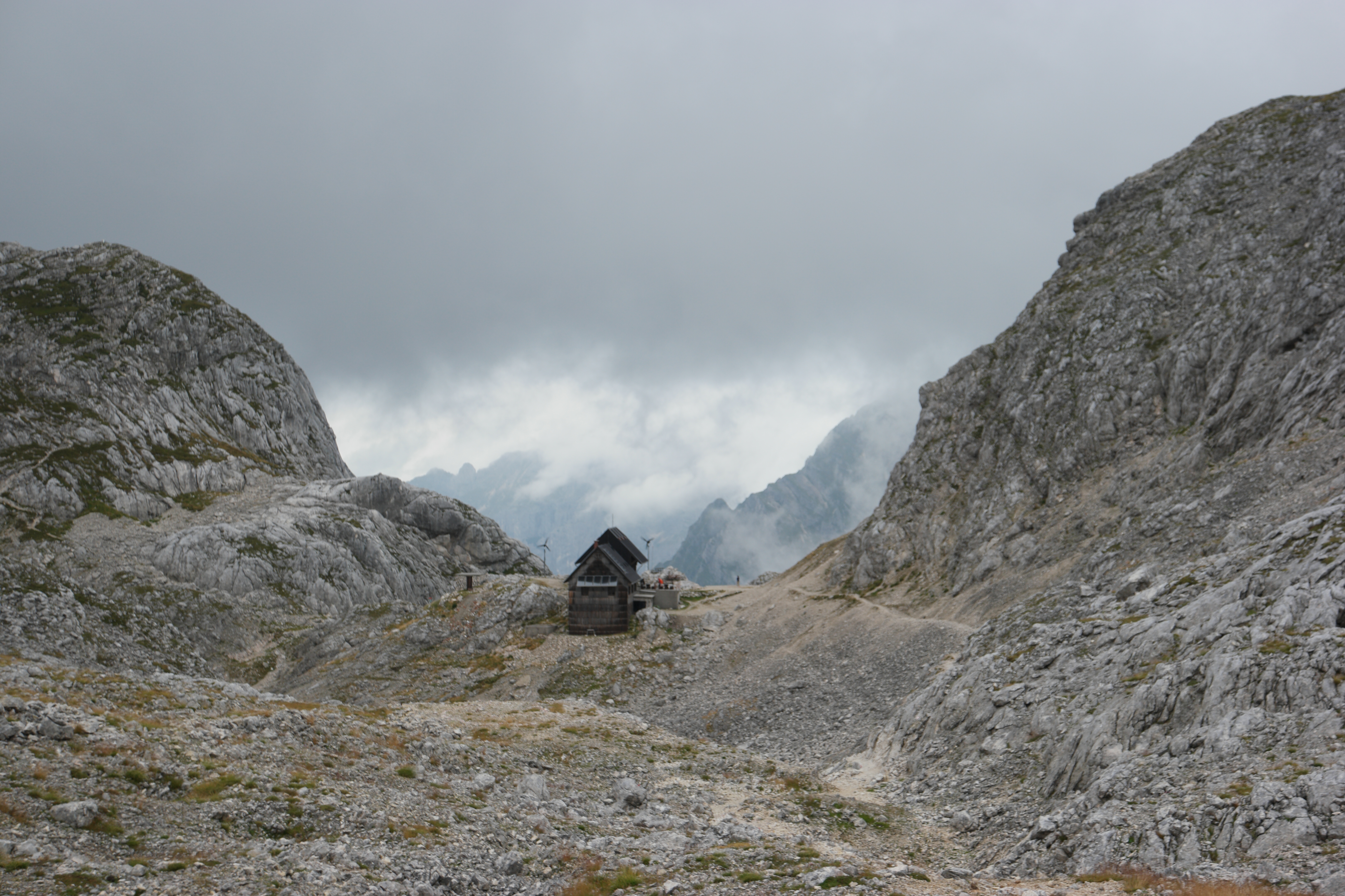
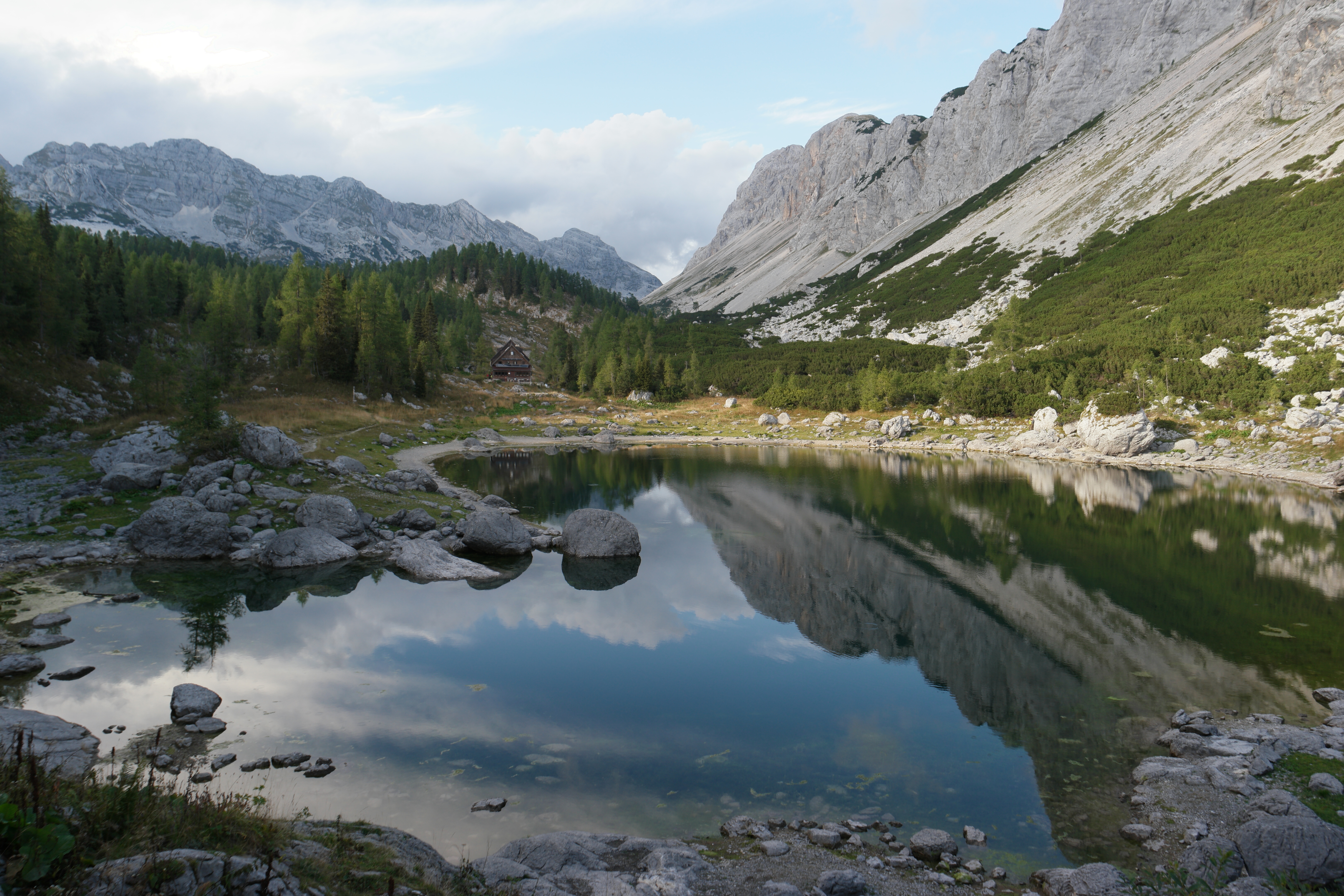
The hut we stayed in on the second night (Pogačnikov Dom)

The hut on the second night (Pognačnikov Dom)
The hut for the third night (Koča na Doliču)
Hitting the spot!
Day 4 – Knut’s Birthday
What do you like to do on your birthday? Have a lie in, breakfast in bed, glass of wine or two with friends?
Not Konstantin.
Having scaled Razor two days before, he was keen to take on Triglav, Slovenia’s highest mountain. But we didn’t really have enough time in the schedule. It was at least 4 hours up and down from the hut, and we had another 8 hours of hiking after that.
Not put off by the seemingly ridiculous, Konstantin set his alarm clock for 5am (on his birthday) and set off to run up Slovenia’s highest mountain.
I was awoken at about 8am by Knut coming back into the hut. He’d got up and down in 2 hours.
“Happy birthday. You are mental” I said sleeply from the comfort of my bed.
Knut beamed, and then looked a bit sheepish. “Urmmmmmm, I broke the go pro. It fell off the mountain”.
I’m meant to be the clumsy one, so this is probably one of the highlights of our relationship so far.
We spent the rest of the day walking down the mountain trying to avoid the lightening storms and enjoying the amazing scenery.
Walking across the rocks
The fourth hut (Koča pri Triglavskih jezerih
Get Planning
I can’t sing the praises of Slovenia and the Julian Alps highly enough. It was truly stunning.
We flew into Ljubljana and got a shared minibus from the airport to Bled (we didn’t book this in advance, and were able to jump in one that left about 20 minutes after we landed).
We stayed in Bled for a couple of days – well worth it – a beautiful city.
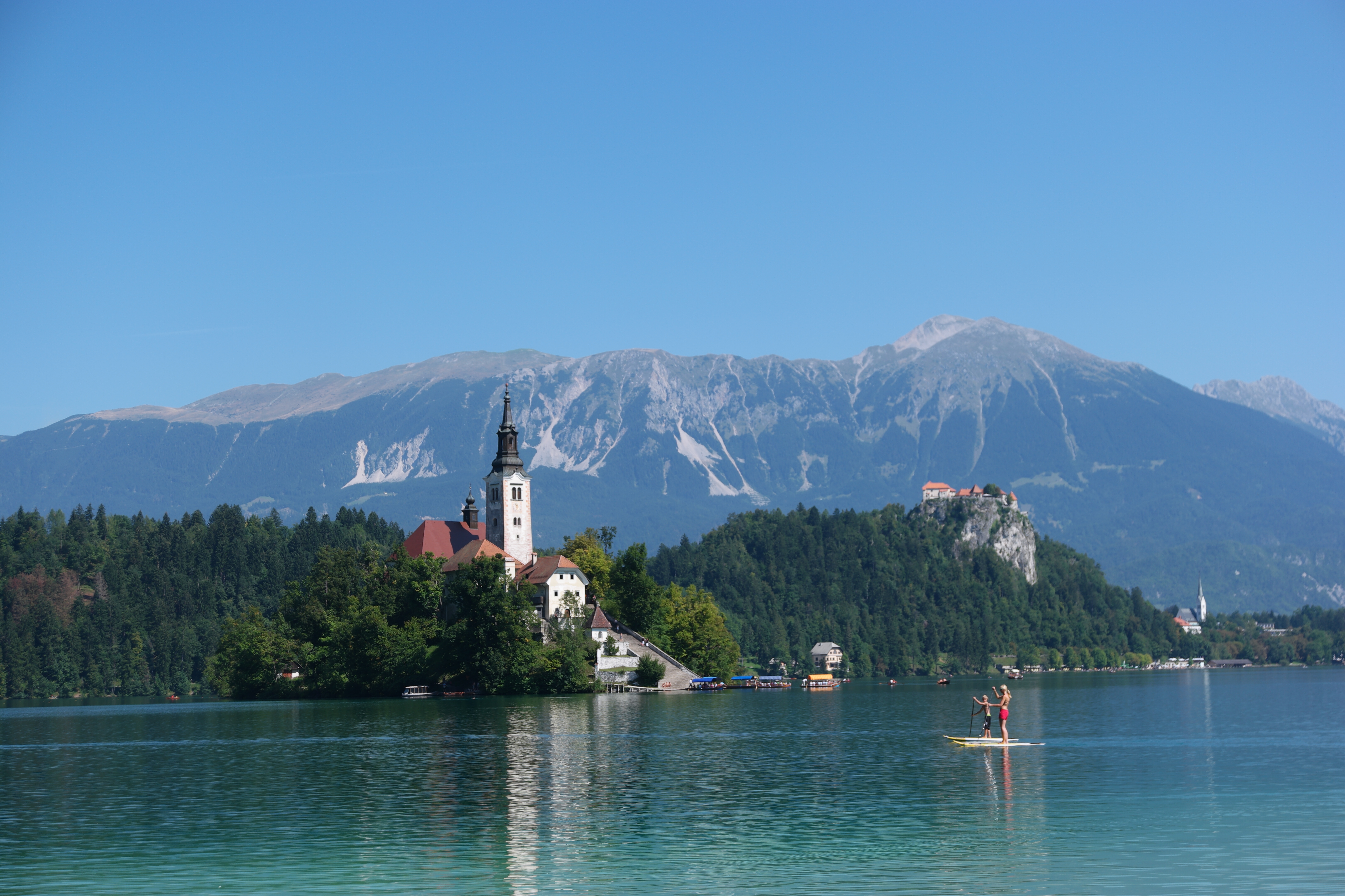
Looking across Lake Bled
Then we took a bus to Kranjska Gora – a town north of the Julian Alps. We started hiking from there.
We used this map. With our route being:
Day 1 – Kranjska Gora to Poštarsk Dom (our plan was to go to Pogačnikov dom for the first night, but we aborted as described above!)
Day 2 – Poštarsk dom to Pogačnikov dom (via Razor)
Day 3 – Pogačnikov dom to Koča na Doliču
Day 4 – Koča na Doliču to Koča pri Triglavskih
Day 5 – Koča pri Triglavskih to Lake Bohinj
We ended at Lake Bohinj and then took a bus back to Ljubliana.
On the trip we stayed in Mountain Huts. These we really awesome and cost about £14 for a bed and £6-7 for dinner. Which was very yummy. In most of the remote huts there was no running water, so factor in having to buy water, and being unable to fill it up when you’re on the move. Nowhere accepted card so bring enough cash.
We didn’t book any of the huts and were fine – but we were advised that the huts near Triglav can get really busy and particularly through August it is worth booking (we were there the first week of September).
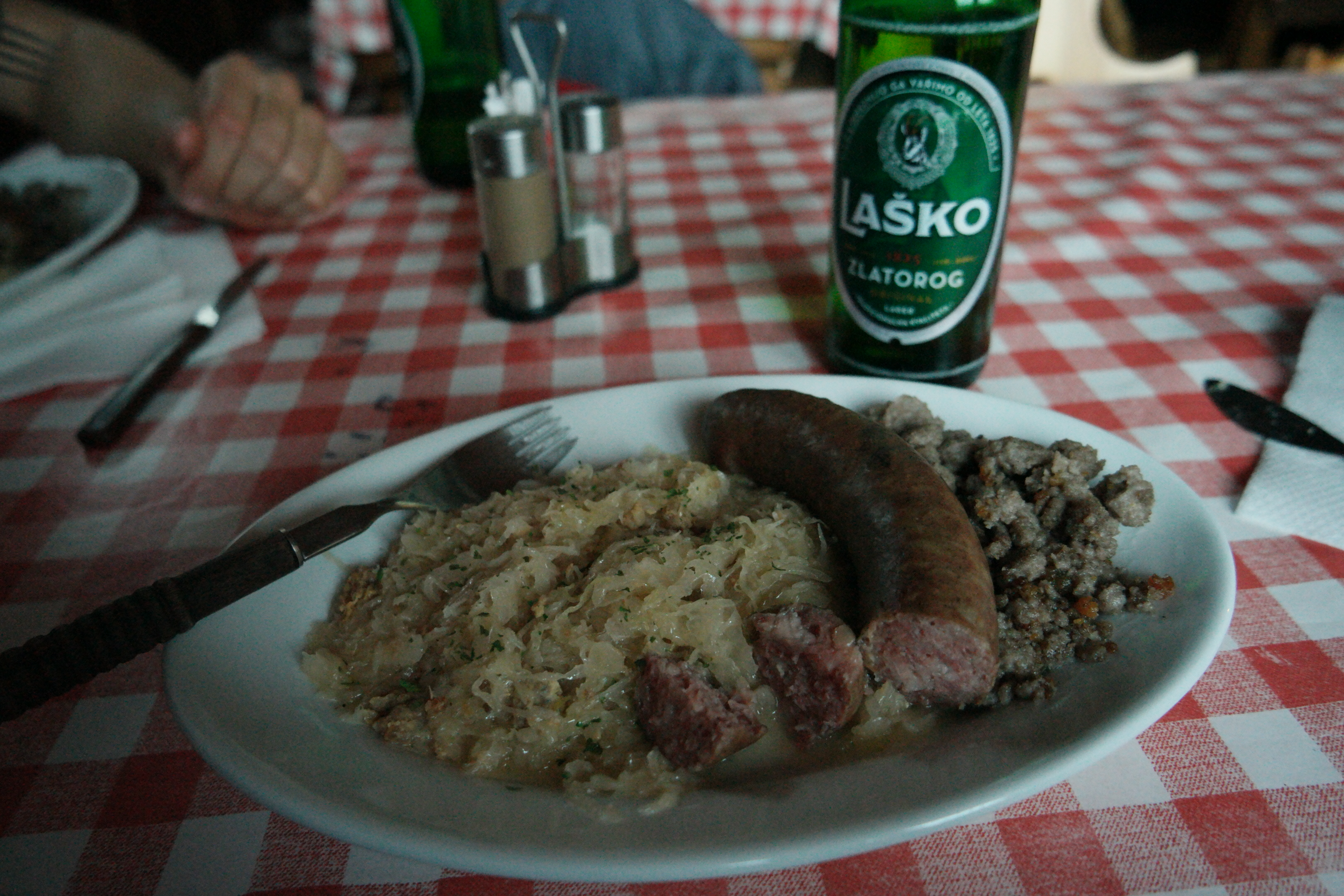
Some of the very yummy food in the huts
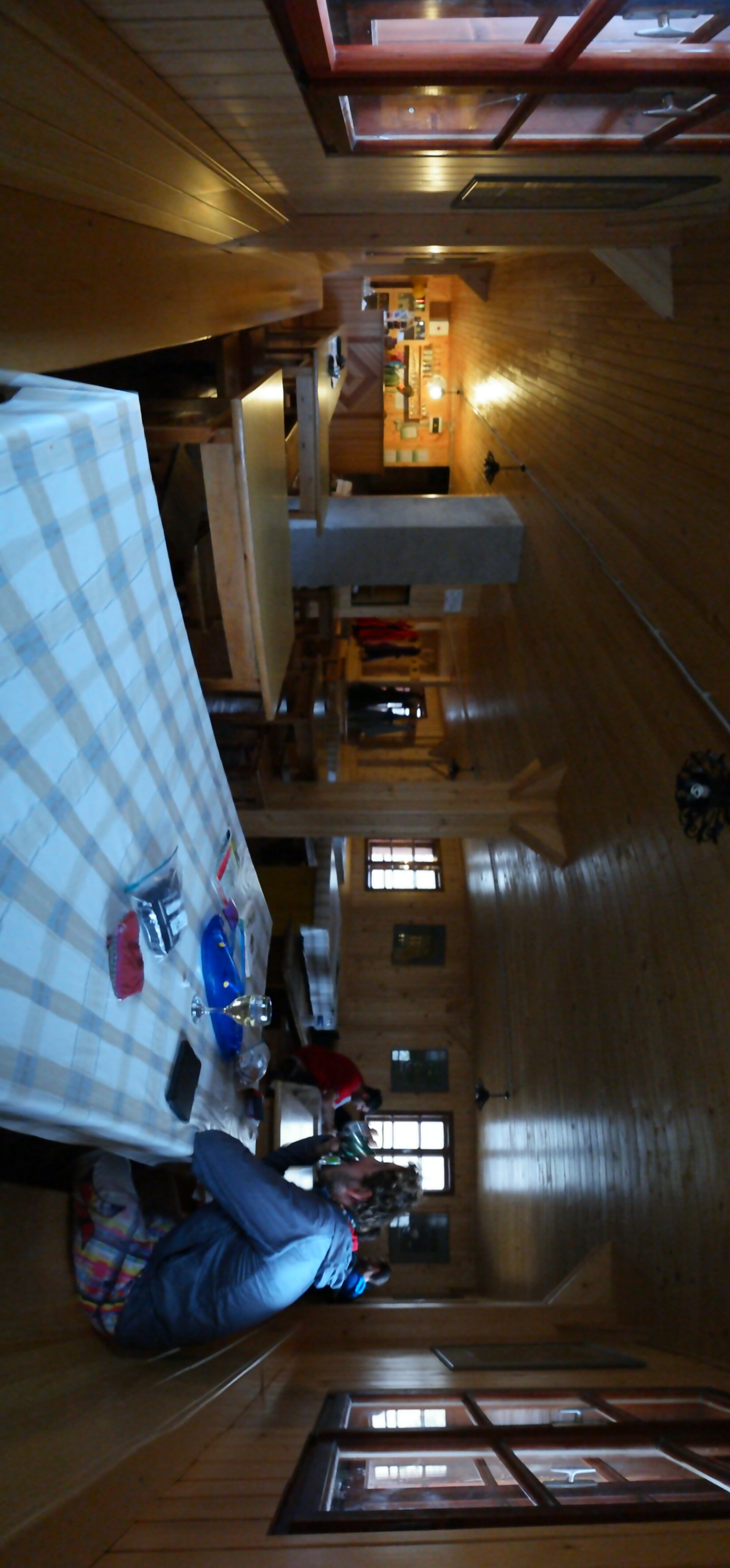
Inside the hut for the third night
How good at hiking do you need to be? If you have walked up Crib Goch to Snowdon and found it okay, you’ll be alright. If you were clinging on for dear life and hated every minute….the Julian Alps may not be for you. Bringing a via feratta kit wouldn’t be over the top!
That said, there are different levels of paths and you can get quite far in without having to scramble or cling onto a cliff face. There are also lots of guided hikes available from Bled and Lake Bohinj.
So, get booking your trip. Now!