If you’re looking to do a cycling trip through Mexico (specifically from Mexico City south), we’ve pulled together an overview of our route, thoughts on accommodation and other (hopefully useful…) information from our experiences in March-May 2018 to help you plan.
If you’re interested in reading a bit more of the story behind these trips you can read about our journey from Mexico City to Oaxaca here and our trip from Oaxaca to the Belize border here.
The Route
To help with your planning, we’ve pulled together a map (including locations of where we stayed) below:
This route is available broken down into our day by day schedule as a google drive document for you to copy and paste and edit if you wish:
https://docs.google.com/spreadsheets/d/1KjJ2pyxQQpuzAAMEZ9kocF9UxdaCq78FxQc7k27fSRo/edit?usp=sharing
We found one of the best ways to suss out a route was to google street view it – you can see if there’s a shoulder and what the traffic looked like (admittedly only in those few seconds the street view car was going through!).
Route Options (Mexico City):
There are a lot of options through Mexico and we found it quite difficult to find the merits and downsides of them! Just to note, we only ended up in Mexico City because my family came to visit for a holiday and that was their final stop. You could avoid it all together and just hug the West Coast.
Anyway, assuming you’ve found yourself in Mexico City with a bicycle, there seems to be a three main route choices south from Mexico City:
- South to the Coast – I don’t really know anything about this option as we were pretty set on visiting Puebla and Oaxaca, and I think if you’d made the effort of cycling all the way inland to Mexico City it would be odd to head straight back out to the Coast and miss out Puebla
- Central to Puebla – this was our choice, and has some sub-choices I’ll discuss below!
- North to the Coast – Again, we didn’t look into this option, but it seems to be a good one for people who want to head to Veracruz and then hug the coast along to the Yucatan.
Cycling out of Mexico City
We deliberated about taking public transport out of the city, but ended up taking the hard road. We have some tips below:
– Pick your time and day – if you can cycle out on a Sunday the traffic is a lot better. We cycled out at 10am on a Tuesday and it wasn’t awful…but on Sunday it looked really good!
– The traffic is bad, the drivers are slightly erratic BUT it does depend on your experience of city driving. If you’ve only ever cycled round Copenhagen you will find it horrible, but if you’ve cycled London rush hour traffic, it’s fine. We didn’t have any near misses in 30km of city cycling.
– The navigation is pretty hard. Google does its best to take you on cycle paths – but often they are split by 6 lane roads that are quite hard to get across (I’ve shared our route below with a few specific notes).
– There are some actually quite nice cycle paths if you take a Southern route out of the city towards Xochimilco. There is a canal that goes through the city with a cycle path alongside it (although some of it is unpaved)!
– It’s pretty slow going with traffic lights, speed bumps and navigation – it took us about an hour to do 10km.
Here is a detailed google map of our route with specific notes on road conditions:
I shared this on the Bicycle Touring and Bikepacking group and was given another suggestion and link to a route here: https://www.strava.com/activities/382890133
Route Options (Mexico City to Oaxaca via Puebla)
Assuming you’ve chosen the Central to Puebla option, and you’ve navigated your way out of one the largest cities in the world the main choice in heading to Puebla is to cycle the Paso de Cortes or not. On the one hand, it is incredible – the views are amazing, but on the other, it is a real slog. The altitude rises to 3700m which makes breathing pretty difficult and cycling hard. Coming from the north the road is paved on the way up, but a pretty tricky dirt road on the down. It is possible to avoid the towering heights of the pass by heading the road south of it.
On from Puebla the main options are:
- Head north to Veracruz (we didn’t do this and don’t know much about it)
- Cycle the 190 to Oaxaca (no hard shoulder)
- Cycle the 135D (hardshoulder) or 135 to Oaxaca
We deliberated for ages between the 190 and 135D, and the problem is once you make a call you don’t really know if it was ever the right one (unless, of course, you go back and re-cycle the area, but I’m not that committed to this blog!). Most of the people we asked for advice had done the 135D. It was okay. The cycling and safety element were fine – the gradients of the hills weren’t too tough and there was a big hard shoulder. But, well, it wasn’t exactly inspiring cycling. It was also very very hot.
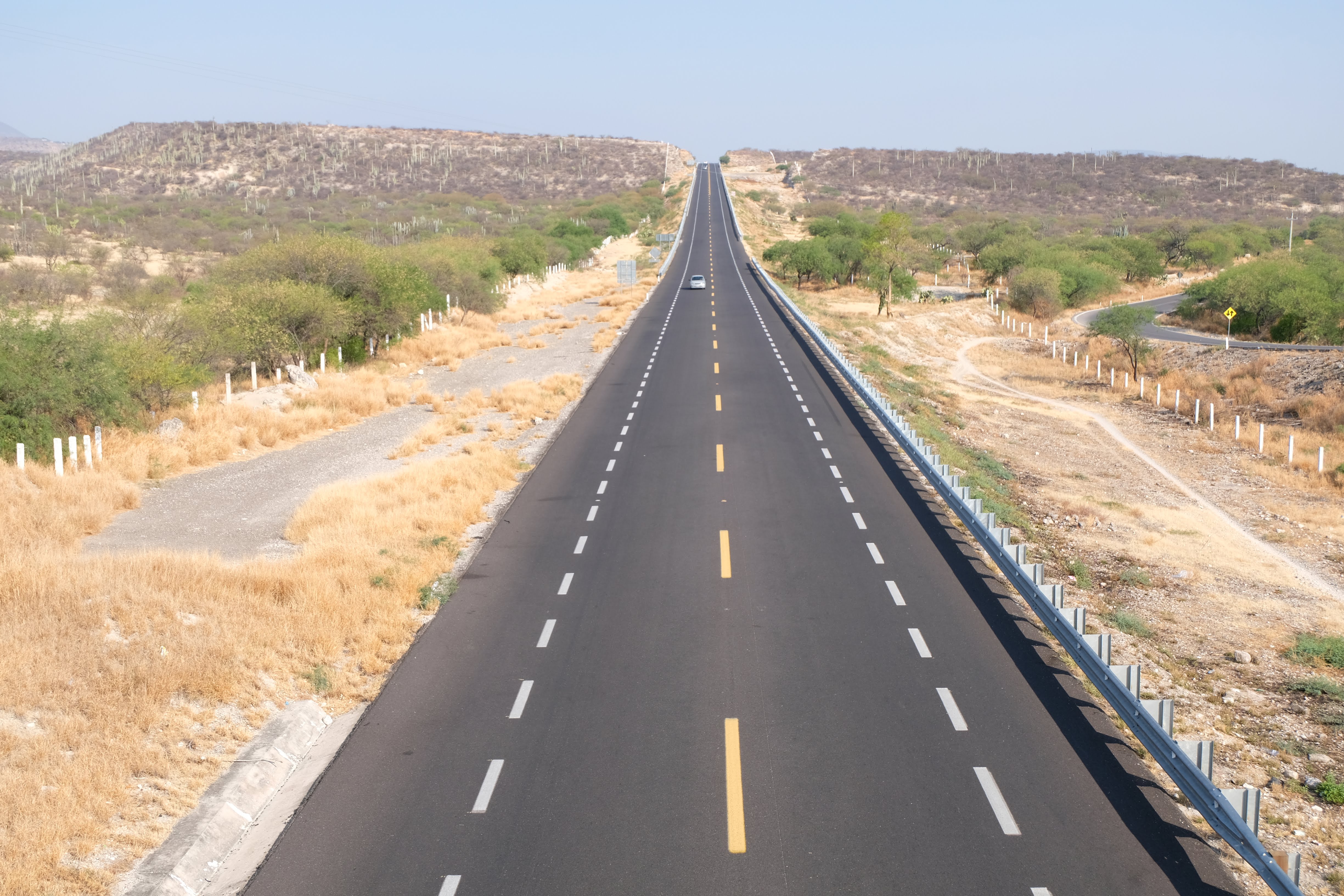
Big hard shoulders on the 135D, but no protection from the sun
We would recommend detours where google recommends them off the main roads into some of the smaller communities like San Gabriel and Tamazulapan. This second detour actually took us on the 190 for a bit and I would say there was probably a bit more to see and keep the mind occupied than the 135D.
Route Options (Oaxaca to San Cristobal)
We’d really recommend a trip to San Cristobal, but you can completely avoid it and just drop down to the coast after Oaxaca and go into Guatemala that way. Assuming you do want to visit San Cristobal there are two main options:
- The federal highway direct from Oaxaca, the inland route. We didn’t take this route but were told by a local cyclist in Oaxaca that it isn’t very nice – big roads, lots of traffic, not great scenery. But, quicker and probably a lot cooler than the coastal route.
- Dropping down to the Coast, with sub options:
- to Puerto Escondido – we didn’t go this way but have heard the town is pretty cool – a real surfing spot. You’d maximise your time on the coast, but it is a little bit more out of the way, so makes it the longest option.
- to Zipolite/Mazunte – this is the route we chose. You get to visit San Jose del Pacifico – a super chilled out mountain town with a hippy vibe (where you can also go to saunas and try magic mushrooms). We’ll admit though, we didn’t cycle out of Oaxaca – we shoved our bikes on a collectivo. We weren’t feeling very well and couldn’t face the huge amount of ascent to the town. The cycle ride down from San Jose to the coast was one of the most fun we did in Mexico.
Cycling along the coast was great – but really hot. Like 38 degrees hot (in April). We took it slowly and dropped into a few of the beaches on the way. We took google’s routing from Salina Cruz along the back roads to Juchitan de Zaragoza (these were mostly okay, apart from about 7km of sand!), and then from there along the back roads to Arriaga (these were much better, apart from about 5km of slightly muddy areas).
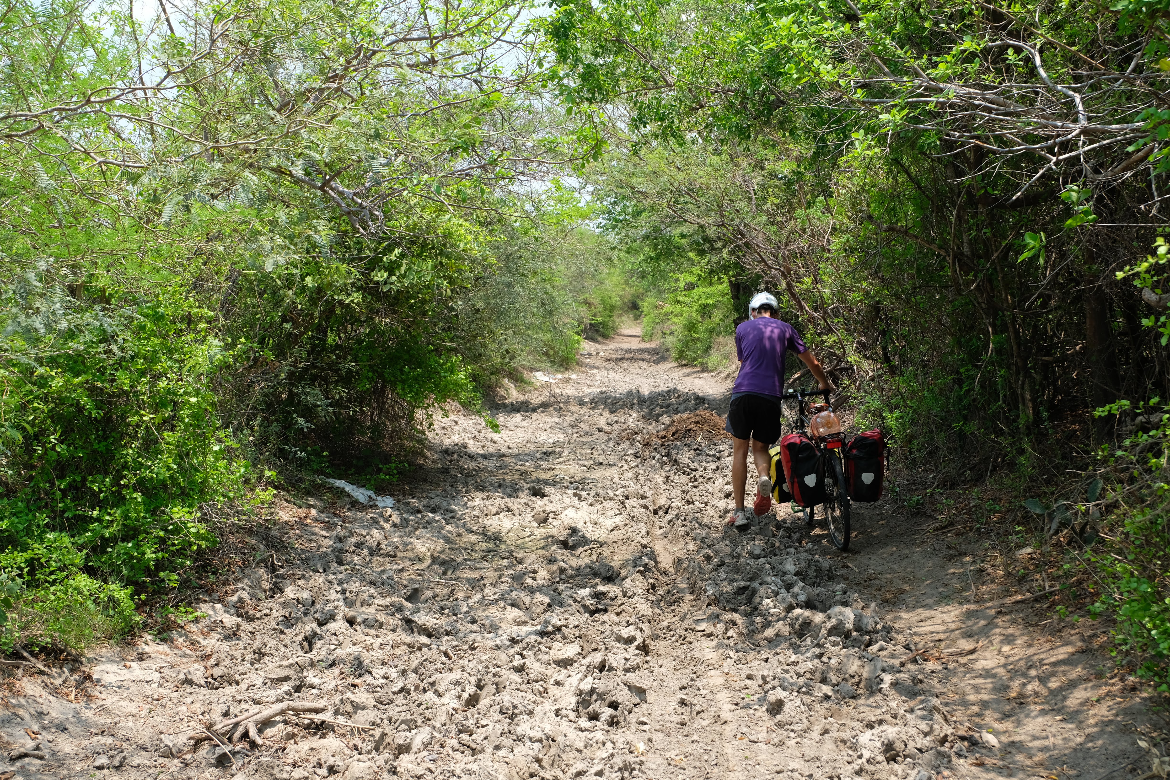
Some of the slightly more difficult sections!
From Arriaga we took the road up to the 190 (it doesn’t seem to have a name). It was great from Arriaga to the junction of the 190 (although turns out we were cycling on a national holiday so there may have been less traffic). But on the 190 up towards Tuxtla the traffic was pretty awful. We actually bailed at Cintalapa and took a bus into Tuxtla, and then from Tuxtla to San Cristobal. If you have the strength in your legs – it is probably better to take the 190D from Arriaga to Tuxtla, but it is long and there are no hotels (so you would have to be wild camping if you want to stay over).
San Cristobal/Chiapas Route Options
As we arrived in Chiapas in April 2018 we heard about the sad death of Krzystof Chmielewski, a cycle tourist from Poland, and the fact Holger Franz, a cycle tourist from Germany was missing – somewhere from San Cristobal to Palenque. The more we heard about the suspicious circumstances surrounding this death and the missing cyclist, the more worried we got. Eventually on the 5th May the death of Holger was also confirmed. Although, at the time of writing, the ‘official report’ is that they ‘fell off a cliff’, an independent investigation from a local lawyer has cast a lot of doubt on this version of events. The more we heard, the less we wanted to cycle – so hence the buses between Tuxtla and San Cristobal, and then onto Palenque.
Anyway, so, we haven’t done any cycling in Chiapas. But, for the sake of this article about route options, from San Cristobal you have a few options, depending on your next steps:
- Down the 190 into Guatemala. We haven’t done this so can’t comment
- Down the 199 to Palenque (and then either on to the Yucatan peninsula or across into Northern Guatemala). This was our chosen option, although on a bus. Please, please, please look into the latest reports from this area if choosing to cycle this road.
Accommodation
We found it much more difficult to find wild camping spots on the mainland, and soon just got into the habit of checking in to a hotel.
Generally we found:
- From Mexico City to Puebla, it would have been really hard to find a wild camping spot (or at least a nice one) as it is incredibly built up. I’m sure you can, but it would have either involved asking a local to camp in their garden/restaurant or going really far off the route (both are fine, but given the option of that or just checking into a cheap hotel, we always chose the easy option).
- Along the federal highways it would also be quite difficult to find places to camp – there are often cliffs on both sides, so it would be a lot of effort to drag a bike down. It would also be very difficult to leave the road without being seen because of the level of traffic
- Along the coast it would probably be a lot easier to find places to wild camp but it was also just so ridiculously hot that we wimped out of this and found places with air conditioning.
- Because it was SO hot, we were drinking about 4 litres each a day while cycling, not including any water in the evenings. To wild camp we would have needed to each take at least 10 litres for 2 days worth of cycling and an over night stop, and well, thats a lot of heavy water, so, again, hotels were just a bit easier!
- Hotels were cheap – from about 250 pesos for a double room with a private bathroom and a fan. About 350 for a double with air conditioning.
- Hotels were abundant – nearly every single town had one.
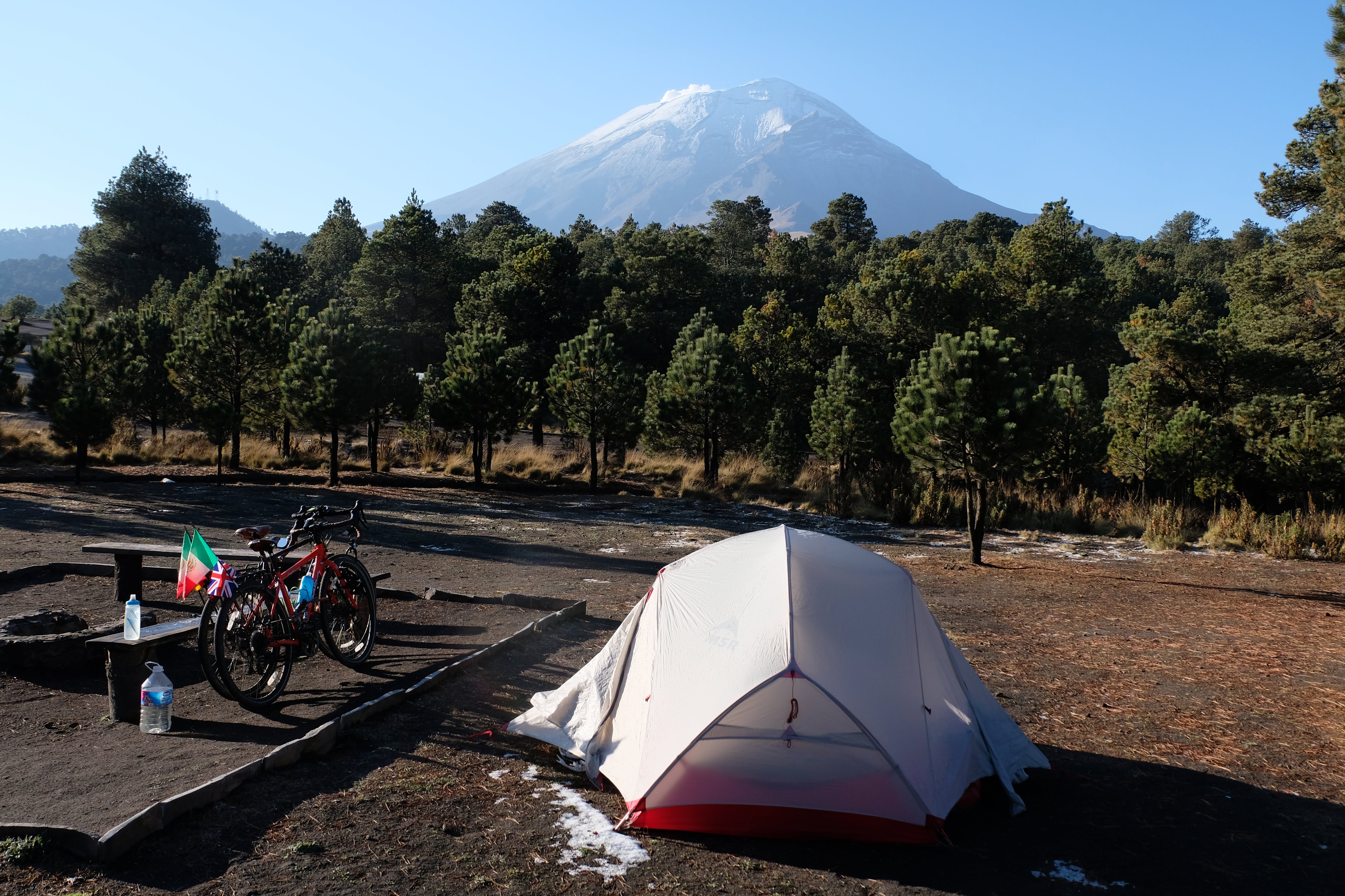
Camping in the shadow of the volcano
Road Safety
The roads were a lot busier, but we still didn’t feel TOO concerned about our safety. Just sometimes the cycling wasn’t exactly pleasant. Generally cars gave us a lot of space and were still quite happy to see us (waving and honking, especially on the hills!).
The general advice appears to be to take the toll roads (usually 3 numbers and a D – e.g. 190D), as they have less traffic as people have to pay to use them, and they have massive hard shoulders. We did find these okay – but they are also used by all the trucks. Also, officially bicycles aren’t allowed on them – we didn’t have any problems, but have heard of cyclists being picked up by the police and taken to an exit.
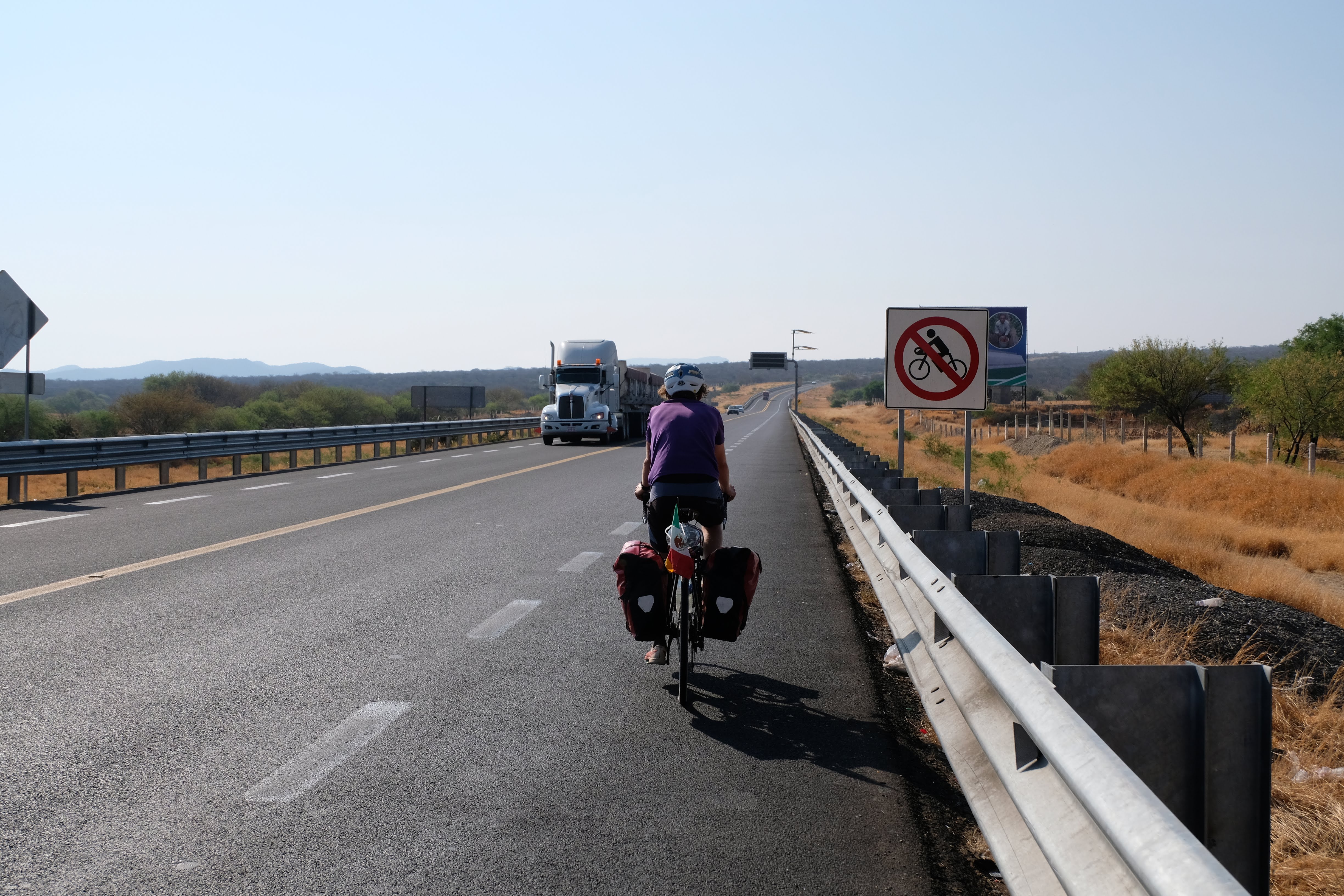
No cyclists allowed…ah well!
Food/Water
Food is very easy to obtain in Mexico! Every town has a little stall selling some variation on a tortilla, meat and salsa. The little towns usually have a small tienda where you can buy biscuits, crisps and other unhealthy treats. We found it slightly easier on the mainland to find fresh fruit and vegetables even in the small towns – but don’t expect too much more than tomatoes, onions, bananas and mangos – and maybe some avocados if you’re lucky! The larger towns were great for a huge range of fresh fruit and veg.
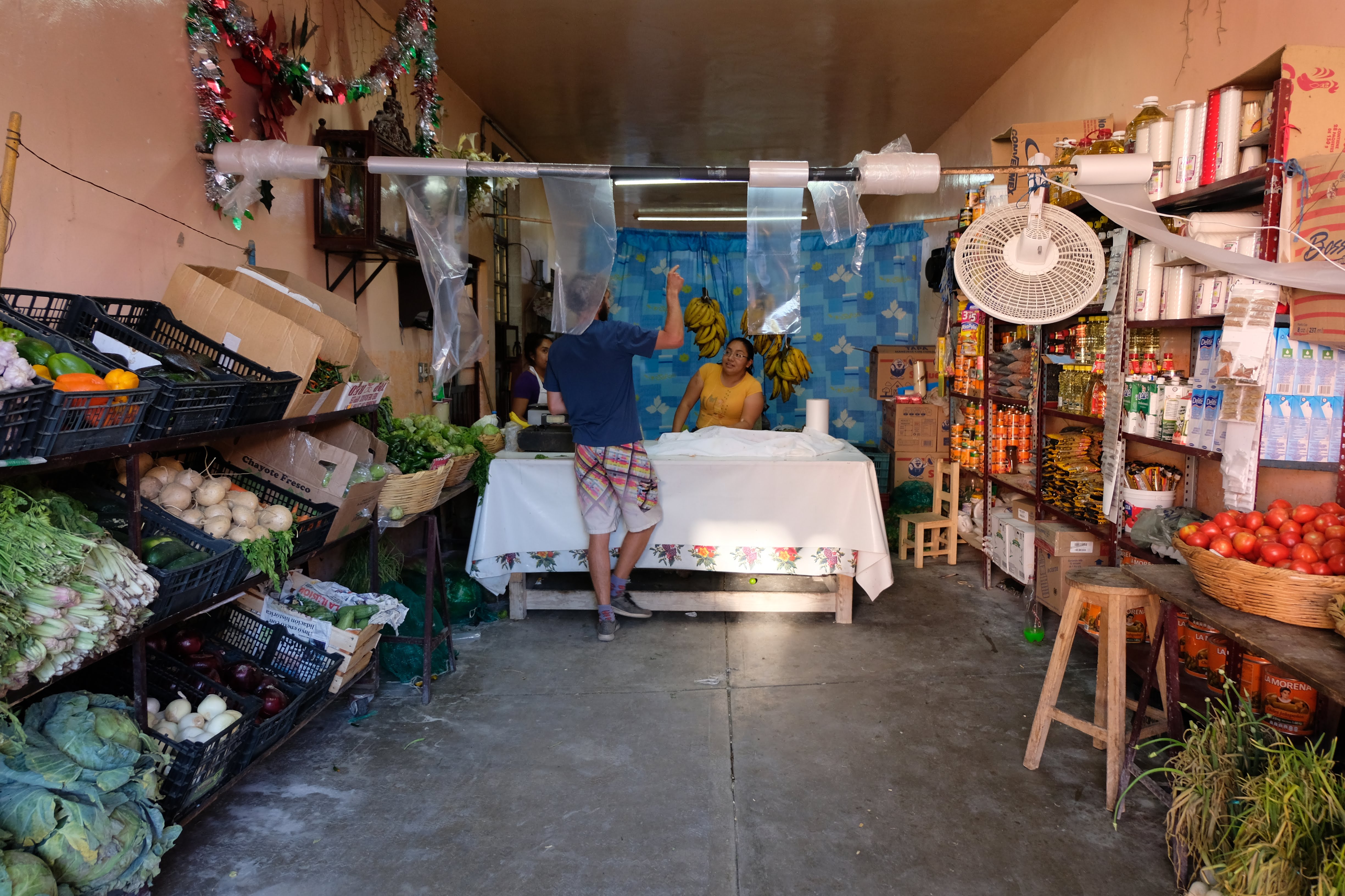
Getting supplies for the next few days
Water was harder. We generally tried to fill up as much as we could from our hotel – either using filtered water if they had it, or using our Steripen to purify the tap water from the bathrooms. We would take 2 litres each on our bikes and then have an extra 6 litre bottle strapped to the back of Konstantin’s bike. We don’t really like buying water while we’re on the rides as it’s just a waste of plastic – but it didn’t seem that easy to be able to fill it up on the go, and there were very few streams/rivers (the ones that were there looked gross). Some towns have purification stations, but these were really hard to find.
Taking Buses
This is SUPER easy in Mexico. We’ve done it on three occasions so far (I’m writing this in San Cristobal and will update when we’ve done the Palenque section).
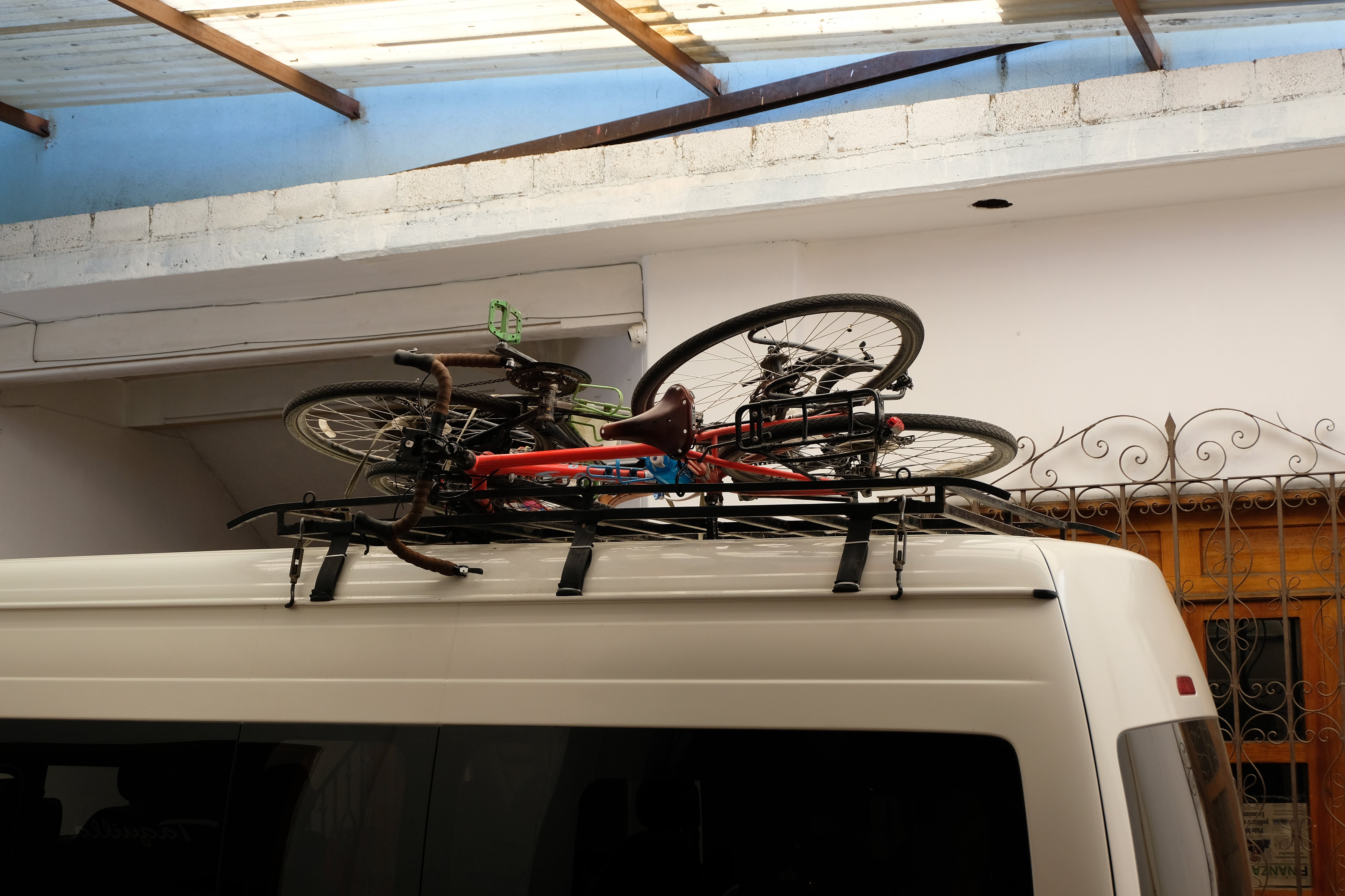
Oaxaca to San Jose Del Pacifico – we used a collectivo that just picked us up from our hostel and strapped the bikes to the roof. Felt very safe and the bikes were absolutely fine in the end. 50 peso tip to the driver for hoisting the bikes onto the roof.
Cintalapas to Tuxtla – we used a company called Rapido del Sur. We rocked up at the bus station and half an hour later our bikes were stowed in the luggage rack under the coach (we had to put them in there). No extra charge for bicycles.
Tuxtla to San Cristobal – we used a company called OCC who were VERY smart. No extra charge for the bikes (although this felt like a mistake…). They were a very professional company and labelled all our bags to ‘check them in’, we had to give every single tag back before they would release them at the other end.
Final points
We never actually felt unsafe in Mexico. We used caution – we only cycled in the day (with absolutely no exceptions), and we kept an eye on any warnings about roads. Staying in hotels probably gave us an extra layer of ‘protection’.
We love this country and really recommend cycling here. Please get in touch if you have any questions, comments or things you’d find useful if we keep doing these.
If you’re interested in reading a bit more of the story behind these trips you can read about our journey from Mexico City to Oaxaca here and our journey from Oaxaca to the Belize border here.
Hello, I am following your trip and is so interesting. Thank you for the information that you get from the road, On June 12, I will depart from Prodhone Bay to Ushuaia. After reading the information about whats has happened with to touring cyclists on the roan betwenn San Cristobal de las Casas and Oconsigo, I get a little afraid on cycling around Mexico. Anayway, thank you for your great information and website. I will follow you.
Take care and be safe.
All the best,
Víctor
[Sorry about my English]
Hi Victor,
Yes it is very scary with the murdered cyclists in Chiapas. We’re in the area where it happened at the moment and have been taking busses to avoid the road where it happened. It has several travel warnings on the app iOverlander as well.
We’ve never felt in danger cycling in Mexico, and generally people are incredibly friendly and courteous towards cyclists here. Of course it’s impossible to know whether we narrowly avoided any dangerous situations without knowing.
Please feel free to get in touch if you have any questions. Safe travels!
Konstantin
Hi! Thank you for sharing all the great information – the trip looks amazing. Wondering if you’d recommend bussing from Mex City to Amecameca (with bikes), spending the night there, and then biking from Amecameca up to the Paseo de Cortes, catching a view of the volcanoes and maybe entering the park to ride around the “ankles” of the mountains, and then biking down to either Puebla or Amecameca again, all in one day… too ambitious? We wouldn’t be loaded down with camping gear, just enough food / water for a solid day of bike climbing. Would love to hear your input !
Hey sorry for the delay in the reply. So I think it would be possible, but it would be a toughy! I just checked my Strava and getting the top was 5 hours moving time for 35km!!! I think it took longer in total than that – but then I really really struggle with altitude, near the top I was basically walking my bike up at 2km an hour! So, if you’re fitter and better at altitude you should be fine! The thing is, the down to Puebla is unpaved, so it’s not a quick one either, that took us about 2.5 hours even though it was all downhill!!! But definitely if you turned and went to Amecameca again it would be easy enough! Good luck – do you guys have an Instagram to follow? Janneke
Also, yes to taking the bus to Amecameca!
Hey guys! What’s your go-to way of getting routes in Mexico while riding? Did you buy a Mexican phone/sim card with data and use Google Maps?
Hi, yes we always get a local SIM card. For navigation we use a combination of Google maps, maps.me, and an app called Komoot.